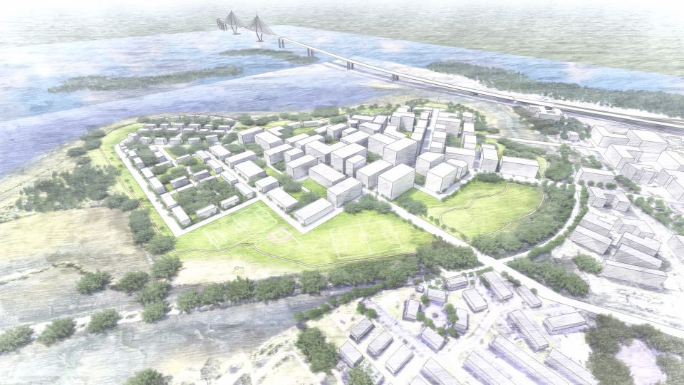
Laurel Island
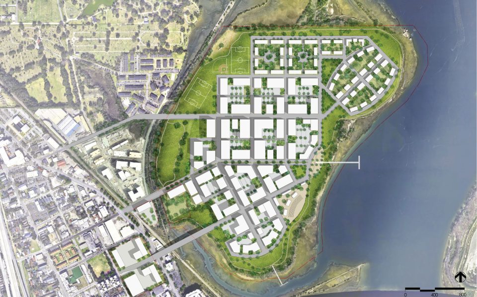
Master PlanThe Laurel Island Master Plan involves an almost 200 acre parcel in the upper peninsula area of downtown Charleston, SC. Its layout was inspired by the peninsula’s historic grid and responds to that of the adjacent East Central neighborhood.
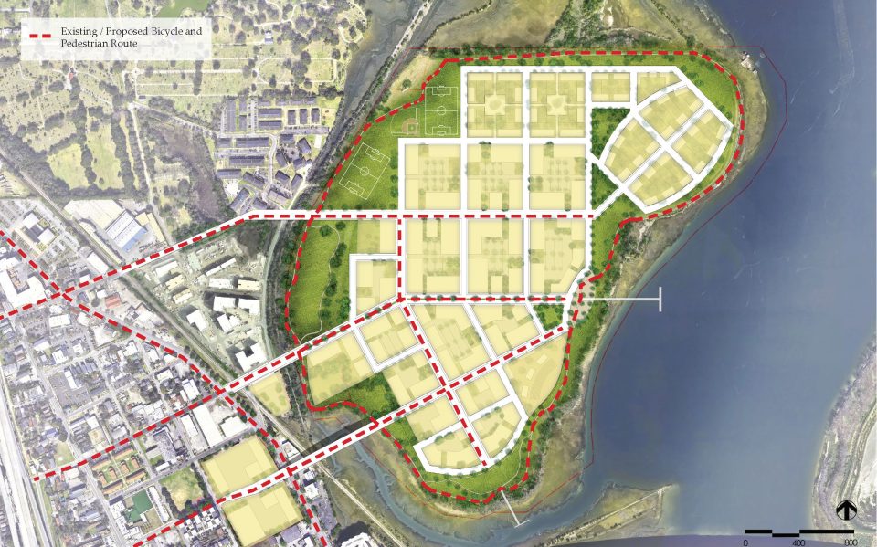
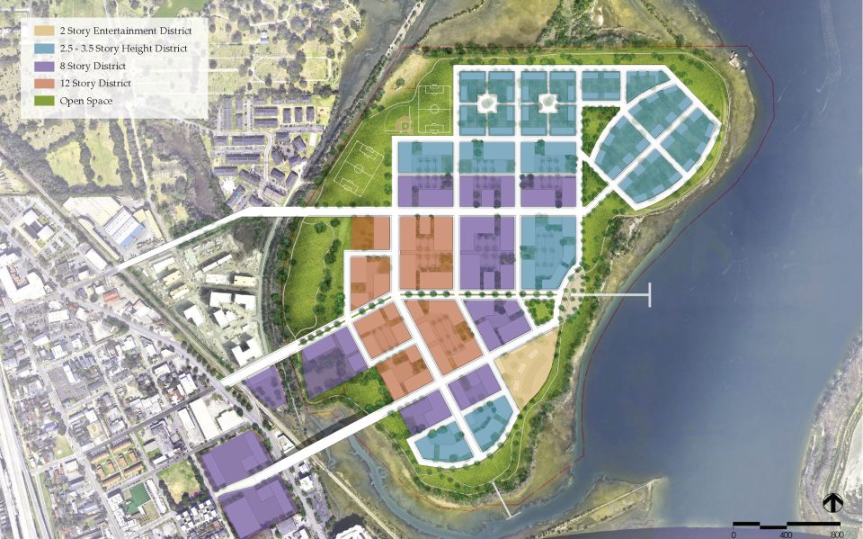
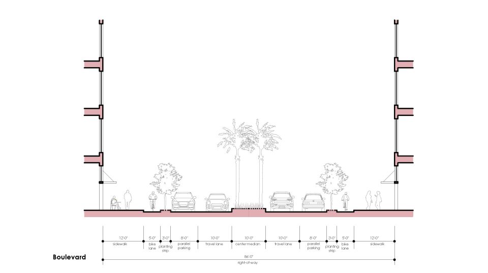
The plan enables a strong connection to the environment by establishing view corridors to the water, incorporating public parks, docks and ballfields on the water’s edge, and providing a pedestrian path that encircles the entire island. Other key features of the Master Plan include establishing new height districts, an emphasis on bicycle transportation as well as the pedestrian experience, enhancements and connections to public transportation, a diverse mix of uses, establishing an independent architectural review board, and the inclusion of affordable housing.
Bello Garris conceptualized, defined and developed the Master Plan and its associated graphics, and led public presentations to neighborhood/advocacy groups and to the City’s Planning Commission.
- Location: Charleston, SC
- Category: Urban Design
- Size: 190 acres